
So what is the future for heat in Fawkner?
The Climate Council have done the numbers and the modelling…
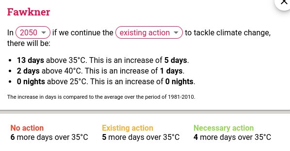
The Climate Council’s Heat Map of Australia is an interactive tool that shows how cutting climate pollution will limit extreme heat in our neighbourhoods. It projects the average number of hot and very hot days, as well as very hot nights, for each suburb by 2050 and 2090, and across three scenarios: no action, continuing with existing action, and taking necessary action in line with Climate Council’s recommendations.
Australian families, workers & communities are already suffering under extreme heat & this will only get worse with more climate pollution. Our leaders must rapidly cut climate pollution to keep our families safe. Try it yoursself: https://www.climatecouncil.org.au/resources/heatmap/


